Creating a World using Hellfire Campaigns part 1
A walkthrough.

I recently procured a copy of Hellfire Campaigns by Jim Webster. It’s an expansion of his Hellfire system for sci-fi platoon or company level wargaming. I haven’t played the base game yet, but I am currently painting up a bunch of 3mm little guys to do just that.
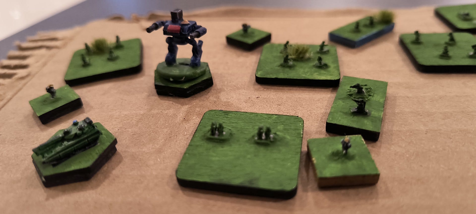
While the game’s reaction-based combat rules attracted me to the game, I noticed that a few content creators that I enjoy, namely Purple Druid and Joy of Wargaming on Youtube were excited about the Campaign supplement, so I decided to pick it up. This isn’t a review, so I won’t do a total rundown of the book. My one criticism is that he needs a proofreader, but then again so do I and that hasn’t stopped me.
So what follows is a rough walk-through of how I am creating my Hellfire Campaign world: Decco IV. I have tried to do it by the book as much as I can bring myself to, and I will try to indicate where I have gone off in my own direction.
Step 1: Create your landmasses:
The world creation rules assume a vaguely earth-like planet. I infer from the main game that there is going to be an earth-like atmosphere and gravity on the planet, and thus would have to be basically earth-sized. In order to generate landmasses, we are told to roll a d20, until the cumulative rolls equal 52 which is the size of a deck of the deck of cards we will be using to detail our world. Each of those rolls is a landmass, and their numbers indicate their relative size. My first “rules-massage” was to change this to 54 in order to include the deck’s jokers, which will be special inclusions to make the world more mine:
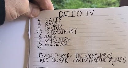
So here we see a number of small continents and one huge one. These are not factions, however. These are landmasses and I expect them to each have multiple poli and nation states in many configurations and situations. Perhaps one of the smaller landmasses will contain a unified state that will allow them to dominate the region around them? Who knows…
Next, we are to draw cards to determine the geography of the landmasses. Webster doesn’t make you do this, but I decided to randomly “shape” the continents by rolling dice to see where to put each card location; I would place the fist one, then roll a d4 to see where the next card went, and then a d3 for the next one after that, and so on:
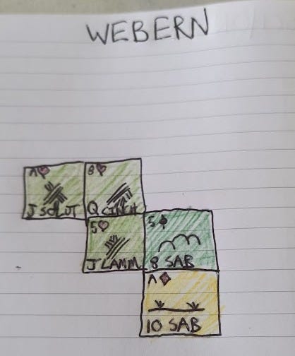
So on the continent of Webern we have 5 areas for which I drew an Ace of Hearts, 8 of Hearts, 5 of Hearts, 5 of Spades and Ace of Diamonds, indicated in the top left of the squares. The suit indicates the type of land and how it is exploited: Hearts are fertile agricultural land, Diamonds are plains, Spades are fertile hills, and Clubs are rugged hills (I consider clubs to be mountains). The number indicates how much income the land can generate, and face cards indicate a major city. So if we look above, we see that Webern is kind of a hardscrabble! Aces are considered “1” here, and 5’s are well below average. So aside from the the 8 of Hearts in the top centre, everything is pretty poor. Whether this is because the continent is geographically very small, or war torn, of environmentally compromised is up to you.
When you are done with a continent, put the cards you used flipped over on the bottom of the deck, as you only use a card once.
Step 2: Create your Populations:
Next, we work out the population. You will need a second deck of cards for this, so get thee to a dollar store! Here we are told that humanity arrivedon the planet in four waves, which are going to be represented by the four suits on the cards. I did it like this:
Hearts: The Sabsi. The original settlers and first sapient life on the planet. Originally a derogatory term for the Persian majority of the generation ships that brought them here and their tendency to use every spare inch of deck space to grow fresh herbs during the journey.
Diamonds: The Lammingware People. Named after a set of Medieval Wargame Campaign rules that became wildly popular 1000 years after they were written, these people came to Decco IV using at-the-time new jump technology. They use robots to mine the valuable minerals such as Contraterrene, and are the ones who built the great Golemworks Factory, which when online was able to created Robots of any size and ability.
Spades: The Solutreans. Refugees from another planet ruined during the great collapse, they brought their riding and herding culture with them and introduced many new species and practices to the plains of Decco IV.
Clubs: The Cinchese. Labourering underclass brought to the planet by the Lammingware people in the wake of the destruction of the Golemworks robot factory.
The suit indicates the population wave that is prevalent in the area, and the number indicates how strongly the people there associate with their culture. I think of it this way: I am from Nova Scotia, and like many if not most (white) Bluenosers I am a person of German heritage who feels no ties to Germany (which I feel is their fault, not ours). The bottom of the Nova Scotia landmass square could say “Ace German”. Make sense?
Like the Landmass deck, I included the two jokers in this deck, in order to introduce a little bit of customization. The red joker represents a race of aliens I call the Deenagankers, who are 4 armed “acid for blood” aliens. When this card is drawn, it will indicate this area is overrun by them. They will have to be dealt with at some point! The black joker will indicate the Metal People, Turing test-passing robots who want nothing more than to capture and reactivate the Golemworks factory to create galaxy-dominating bodies for themselves.
So if we look at Webern above we see that despite being very poor, the people feel very strong associations with their respective population waves. Perhaps Webern is a “place out of time” where it’s poverty has caused a lack of the kinds of change that economic development brings and so clans and little micronations still behave like it was hundreds of years ago?
In the same way as the Landmass deck, we put away the cards we have drawn so far as they will only be used once each.
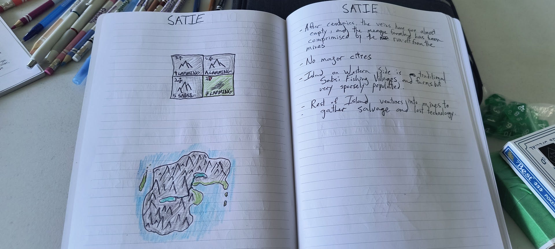
Now we do this for all of the rest of the landmasses, drawing the continents and writing details as I am struck by whimsy:
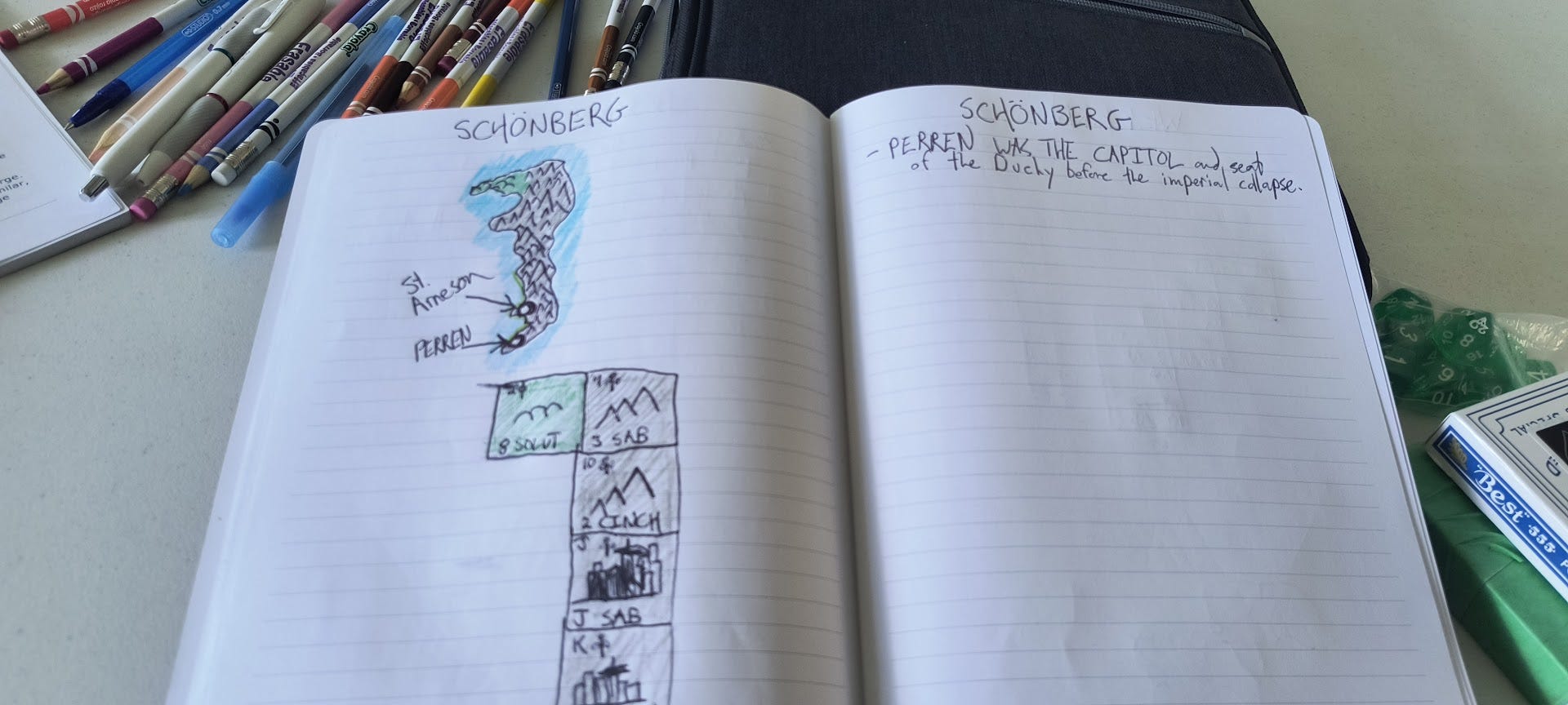
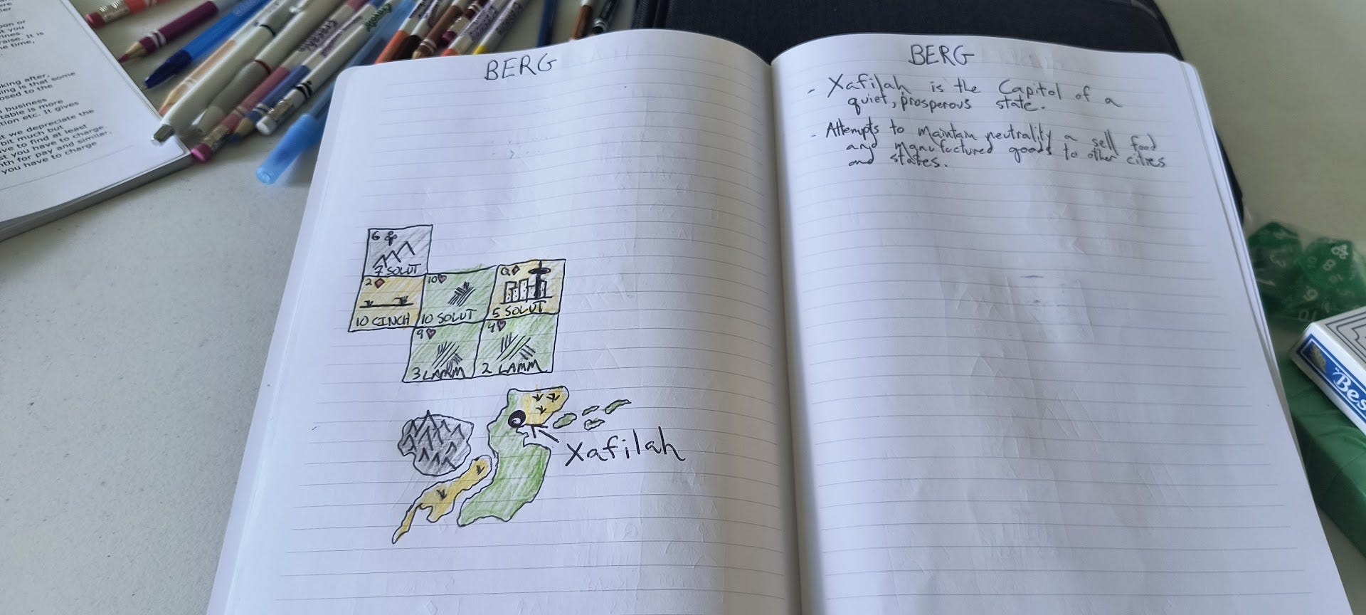
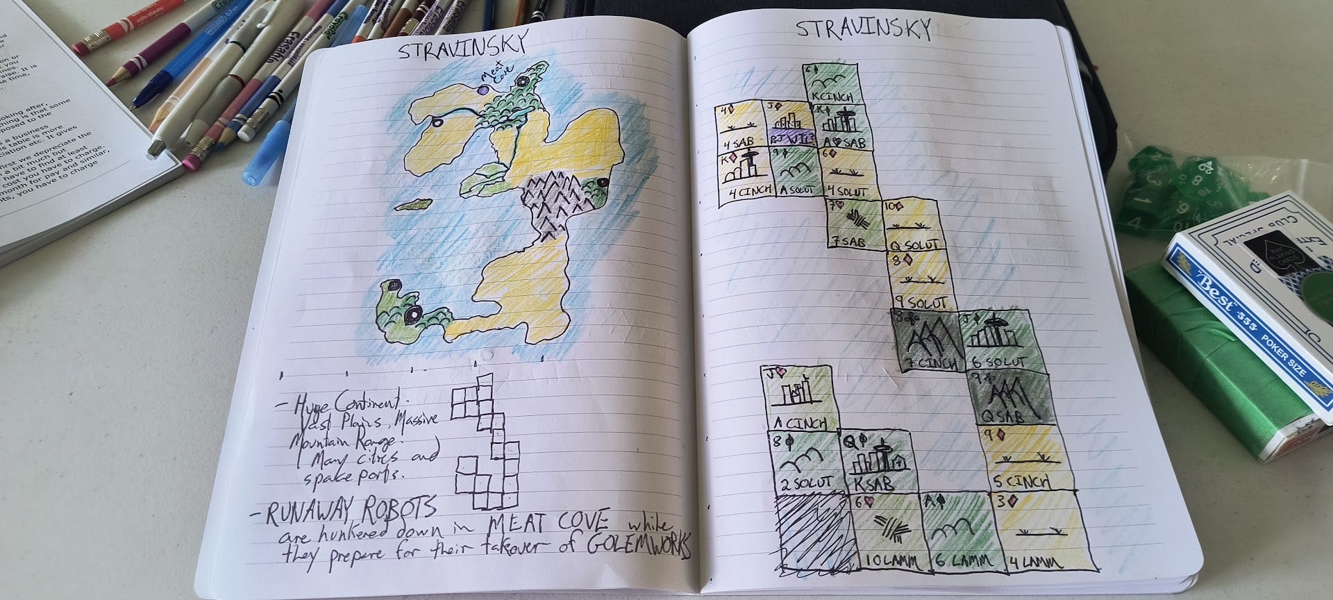
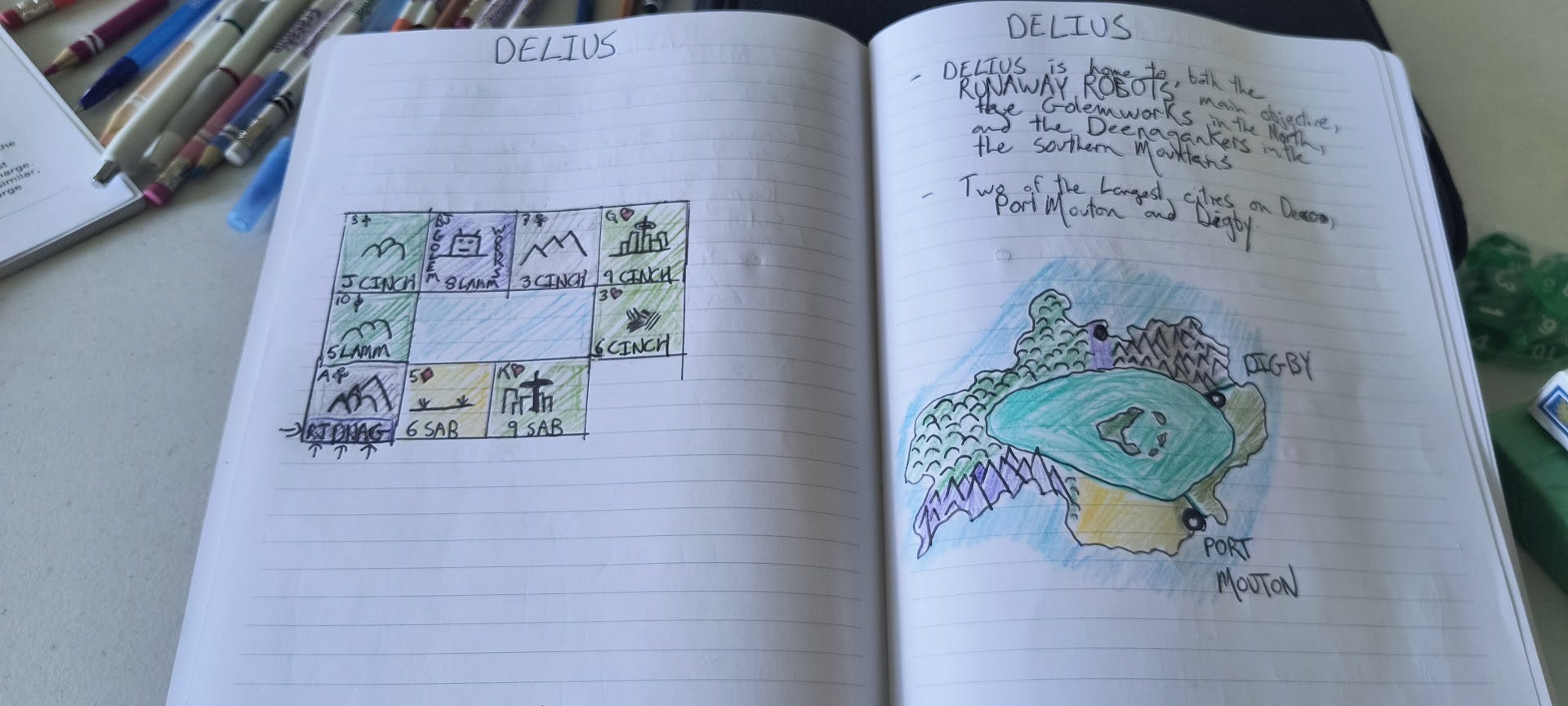
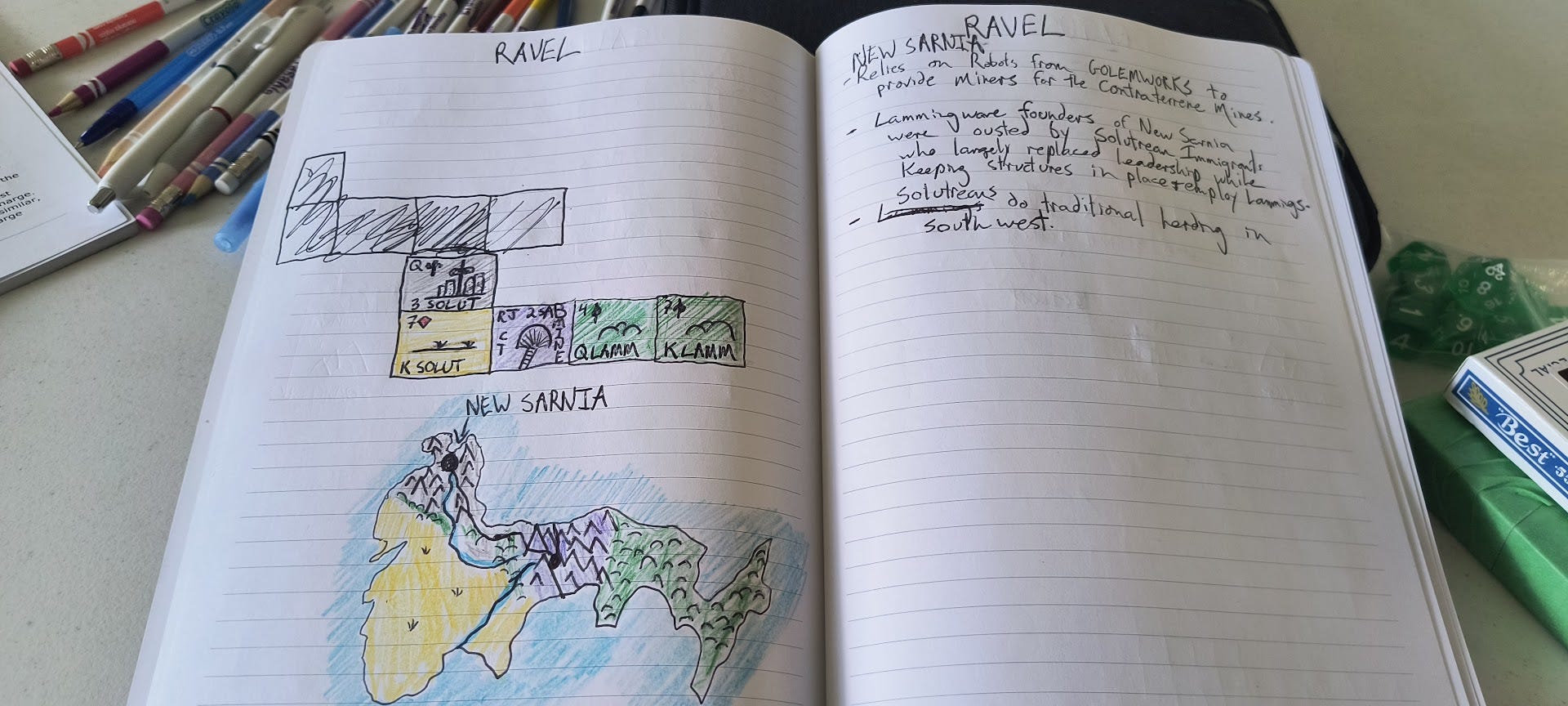
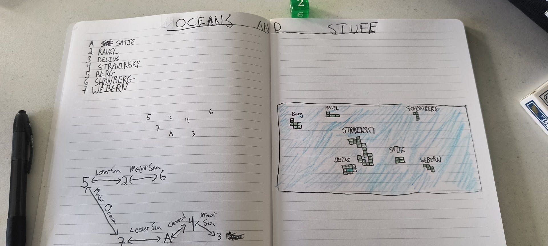
Next, we have to arrange our landmasses and figure out how the relate to each other. This is the weakest part of the instructions in the book, and you kinda-sorta just have to eyeball it. You take two continents and roll a d6 to figure out the size of the distance between them. 1 is a major ocean, and 6 is like the English Channel. Then you sort of place them using the rolls as a guideline. Mine ended up looking like this:
Next, I wanted something a bit more to scale, so assuming that the planet has a similar water to land ratio as earth (2/3 water, right?), we can multiply the number of landmasses by two, add them together and round off to 160, make a grid and plot it out:
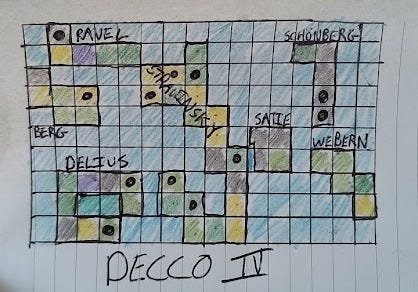
So there we have it. The landmasses and general population of the planet. In future parts we will create economies and, more importantly, reasons to go have wargame campaigns!
This is awesome! Thank you for sharing, and for the shout out.